Mapping the eel migration routes
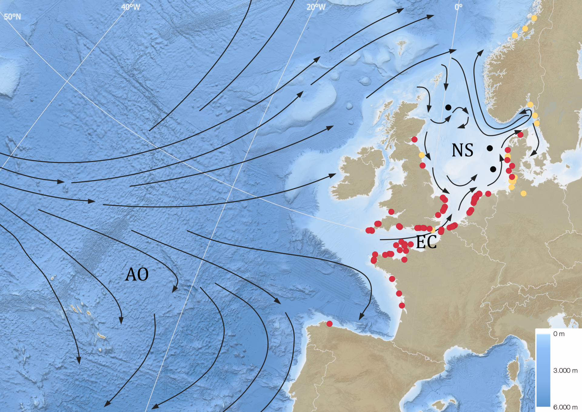 Map with datalogger locations
With the use of 96 data loggers, scientists of the Research Institute for Nature and Forest (INBO), Ghent University and the Flanders Marine Institute (VLIZ) succeeded to map the migration routes of eels in the North Sea. The results show that the majority of the Belgian eels migrate through the English Channel, the narrow sea passage between England and France. Although this seems a logical thing to do, some choose to migrate over Scotland. The reason for these different choices is still under study. The eels are probably guided by certain sea currents.
The European eel has one of the most impressive and complex life cycles in the animal kingdom. They grow in our rivers, but need to migrate at least 7000 m to the spawning grounds in the Atlantic Ocean. The exact location of and the migration routes to these spawning grounds are after millennia of research still poorly known.
Within the European project LifeWatch, researchers from the INBO, Ghent University and VLIZ attached data logging devices to eels to map their migration routes in the North Sea. Pieterjan Verhelst from the INBO: “These data logging devices measure water temperature and depth during the eel’s migration route. After some time, the devices detach from the eel, drift to the sea surface and hopefully wash ashore. Whoever found such a device and sent it back to us was awarded €50. As such, we could download the data and calculate the eel’s trajectory.”
Successful findings
From the 320 deployed data loggers 96 (30%) were retrieved. The majority were found near the bay of the Mont-Saint Michel (France), but substantial numbers were also retrieved along the southern coasts of the UK and the Netherlands.
Whales and sharks
The route was not without danger. Marine predators like whales and sharks ate eleven of our eels. In some cases we were even able to identify the culprit to species level (a pilot whale and a porbeagle shark) based on the species-specific body temperature (after predation the data logger was inside the predator) and the diving pattern.
Bit by bit
Although we couldn’t track the eels until their spawning locations, these results are a valuable contribution to the already known routes (for example the route from Norway over the UK and the route through the Mediterranean Sea). Putting the pieces of the puzzle together on one map, we gradually get a total picture of the various eel migration routes. The final 3000 km to the spawning sites, however, is still shrouded in mystery and requires further research.
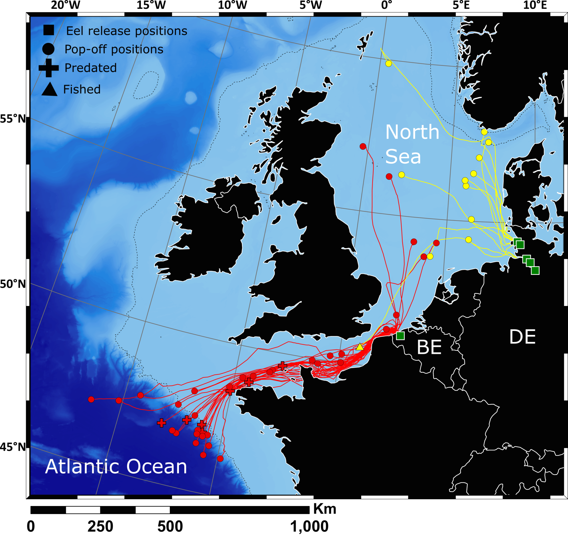 Map with the routes (red line are Belgian eels)
For more info, contact
Pieterjan Verhelst (Research Institute for Nature and Forest)
GSM: +32 499 38 72 87
Email: pieterjan.verhelst@inbo.be
In collaboration with and with financial support by:
-
LifeWatch
-
Research Institute for Nature and Forest (INBO)
-
Ghent University (UGent)
-
Flanders Marine Institute (VLIZ)